In Aurora we repeatedly see the same pattern: two sites on the same street, identical structural design, yet completely different seismic demand once you factor in the glacial stratigraphy. The city sits on a complex stack of Wisconsinan till, outwash sands, and lacustrine silts deposited over the bedrock valley of the Fox River. A uniform site class from the generic IBC maps misses that entirely. Our MASW surveys capture Vs profiles down to 30 meters so the site class reflects what the drill rig actually encounters, not what a 1-km grid cell assumes. When the geophone array lines up across a buried esker or an interbedded soft clay lens, the Vs30 changes by 100 m/s or more. That difference feeds straight into the ground motion scaling, the base shear calculation, and ultimately the tonnage of rebar in the foundation. Aurora's development pressure is moving projects onto parcels that older reports never characterized, which is exactly where microzonation stops being a research exercise and becomes a hard-dollar decision on the structural system.
Two sites, same street, same structural design: the Fox River alluvium can double the spectral acceleration compared to the glacial till fifty meters away.
Technical details of the service in Aurora Illinois
Local geotechnical conditions in Aurora Illinois
Aurora's seismic hazard doesn't come from the large-magnitude plate-boundary events that dominate West Coast practice. The risk here is moderate-magnitude crustal seismicity at shallow depth, amplified selectively by soft soils. A magnitude 5.5 on the Sandwich Fault Zone, thirty kilometers away, produces shaking that a stiff glacial till site handles with minimal amplification, while a neighboring site underlain by fifteen feet of compressible Fox River alluvium rings at two to three times the spectral acceleration. We have mapped this contrast across the east-bank industrial corridors and the older residential grids near downtown, where fill over buried paleochannels creates localized site class transitions within a single city block. The practical consequence: two adjacent buildings designed to the same mapped SDS can experience a 40% difference in actual demand. Microzonation identifies those boundaries before the foundation is poured, giving the structural engineer a defensible basis for site-specific spectra instead of defaulting to the envelope of the USGS hazard curves. The Illinois Emergency Management Agency recognizes these site amplification effects in its updated hazard planning framework, and Aurora's building department increasingly expects project-specific Vs30 documentation for essential facilities and taller wood-frame podium structures.
Our services
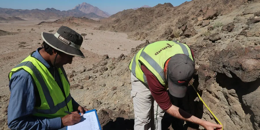
A microzonation study in Aurora is not a single geophysical survey; it is a phased investigation that marries surface wave testing, intrusive sampling, and site-response analysis. The scope depends on the project's risk category and the complexity of the subsurface. For a three-story medical office building on a known paleochannel, the approach is entirely different than for a tilt-up warehouse on dense moraine till. Our technical team defines the deliverables around the specific decision the structural engineer faces: site class confirmation, liquefaction screening, or full site-specific response spectra.
Vs30 Site Classification Mapping
Active and passive MASW arrays deployed in orthogonal lines to capture lateral velocity variations. We correlate the shear-wave velocity profile with SPT borings, classify each grid node per ASCE 7-22 Table 20.3-1, and deliver a GIS-compatible site class map with contours of SDS and SD1 for direct import into the structural model.
Site-Specific Ground Response Analysis
One-dimensional equivalent-linear or nonlinear wave propagation using DEEPSOIL or equivalent software. Input motions are scaled from the 2023 USGS National Seismic Hazard Model and propagated through the measured velocity and modulus degradation curves from resonant column or triaxial testing on undisturbed samples. The output is a surface response spectrum that frequently differs materially from the ASCE 7 generic envelope.
Liquefaction Hazard Microzonation
SPT-based liquefaction triggering analysis using the NCEER/Youd-Idriss simplified procedure updated for the site-specific moment magnitude and peak ground acceleration. We map factor of safety against liquefaction, estimate post-liquefaction settlement per the Ishihara-Yoshimine method, and delineate zones where Improvement or deep foundations become mandatory under IBC Section 1804.5.
Common questions
How much does a seismic microzonation study cost for a typical Aurora commercial project?
For a single-structure commercial parcel in Aurora, the investigation typically ranges from US$4,820 to US$16,290 depending on the number of MASW lines, the depth of investigation, and whether laboratory dynamic testing is required. A basic Vs30 site class confirmation with two orthogonal array lines and one calibration boring falls at the lower end. A full microzonation for a multi-acre campus with site-response modeling, liquefaction screening, and GIS deliverables runs toward the upper bound. Every proposal is scoped against the specific structural questions the project poses.
Does Aurora require site-specific seismic microzonation by code?
The IBC 2021, adopted by Illinois, permits site-specific ground motion analysis under Section 1613.2. While a default Site Class D is commonly assumed, the code allows—and in Risk Category III and IV structures effectively encourages—site-specific Vs30 determination. The City of Aurora building department has increasingly requested site class documentation for essential facilities, podium construction, and projects on the Fox River floodplain where soft soils are known to exist. The site-specific spectrum often yields a more economical design than the conservative default envelope.
What is the difference between a regional hazard map and a microzonation study?
A regional hazard map, such as the USGS National Seismic Hazard Model, provides probabilistic ground motion estimates on a coarse grid that does not capture local site amplification from soft soils. A microzonation study measures shear-wave velocity directly at the project site, classifies the soil profile per ASCE 7 site classes, and propagates the design motion through the actual stratigraphy. The result is a site-specific spectrum that reflects the true dynamic response of the glacial till, alluvium, or fill beneath the structure, not a regional average.
How long does a microzonation field campaign take in Aurora?
Fieldwork for a typical Aurora microzonation study runs two to four days. The team deploys the MASW array, completes the calibration SPT boring, and collects undisturbed samples if laboratory dynamic testing is specified. Laboratory resilient modulus or strain-controlled cyclic triaxial tests add two to three weeks for specimen preparation, saturation, and staged loading. The integrated report with site class maps, ground motion parameters, and geotechnical recommendations follows within three to four weeks of field completion, faster if the structural design schedule demands an interim letter report.